Meeting Highlights
- Funding and overall project status
- Funding remains largely unchanged since the previous meeting.
- The most recent major funding update occurred in February 2026, involving the Longdale trail section and the Central Virginia Transportation Authority.
- Design-Build 1 is open.
- Design-Build 2, covering Petersburg to Chester, remains on schedule for construction to begin in fall 2026.
- Construction is underway in Bryan Park and portions of Henrico County.
- Wayfinding signage has been installed on the Hanover section.
- Bryan Park section
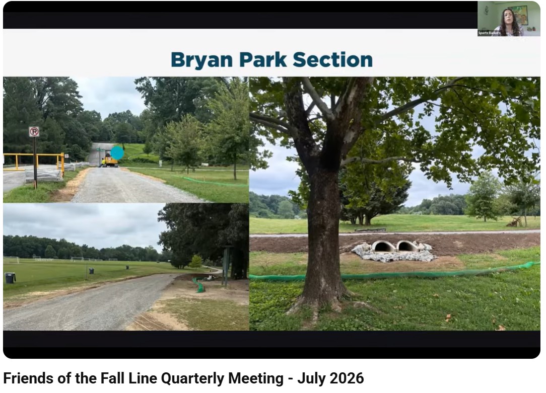
- Most of the trail has been constructed with a gravel base, extending nearly to Bellevue Avenue and beyond the soccer fields.
- Approximately 50% to 60% of the gravel section has been paved.
- Drainage infrastructure, textured crossings, and paving near the park bathhouse have been installed.
- The project remains on schedule for completion on August 21, 2026, with most paving expected to be completed by the end of July.
- A ribbon-cutting date has not yet been determined.
- Design-Build 2: Petersburg to Chester
- All five bridges are nearing final design, although the Skiffes Creek Reservoir bridge is progressing more slowly because of its complexity.
- Trail and roadway plans are nearing completion and are close to being ready for construction.
- Environmental reassessment coordination has reached a major milestone.
- Nearly all parcels are expected to be cleared soon for right-of-way acquisition.
- Environmental permits are nearing completion.
- Construction is expected to begin October 1, 2026, following seasonal tree-clearing restrictions related to protected bats.
- An invitation-only groundbreaking is tentatively planned for September 8, 2026, near Shepherd Stadium in Colonial Heights, with a rain date approximately eight days later.
- Henrico County updates
- The Villa Park segment, running approximately one mile from Lakeside Avenue to East Parham Road, is expected to enter construction soon.
- Sagres Construction has been awarded the Villa Park contract.
- The start was delayed by material lead times and final permitting.
- All Lakeside segments between Bryan Park and Villa Park have been advertised for bids.
- These projects total approximately 2.3 miles and include boardwalks, bridges, a road diet on Hilliard Road, and pedestrian hybrid beacon crossings at Dumbarton and Hilliard roads.
- Bidding closes in late July or early August, with contract awards and construction anticipated in fall 2026.
- The Longdale section is targeted for advertisement in the fourth quarter of 2026, pending property acquisition and utility relocation.
- Chesterfield County updates
- Chesterfield administers just over nine miles of the Fall Line Trail between Design-Build 2 and the Richmond city line at Walmsley Boulevard.
- Approximately six miles remain unfunded, including the major segment between Route 10 and Route 1.
- A small portion will be built through a separate roundabout project.
- Just over three miles are funded, with about 1.5 miles completed or under construction.
- Another 1.5 miles are funded for construction through 2028.
- Chesterfield is updating its bikeways and trails plan as the Active Transportation Plan, with the Fall Line Trail serving as a major network spine.
- The plan also incorporates trail spurs identified in an earlier Fall Line study.
- Planning Commission review is expected in fall 2026, followed by a possible Board of Supervisors vote in December.
- Two pedestrian hybrid beacons have been funded along Route 1 near a trail segment currently under construction.
- Trail-use counter data
- Permanent Eco-Counter devices have been installed near Gwathmey Church Road and Woodman Road.
- The Gwathmey Church Road location recorded approximately 40,000 users from January 1 through July 7.
- Average daily use at Gwathmey Church Road was approximately 239 users, with a peak day of 632 users.
- The Woodman Road location recorded approximately 37,300 users, averaging nearly 200 users per day, with a peak day near 600 users.
- Bicycle and pedestrian use was close to an even split, although the Woodman Road location had slightly more bicycle traffic.
- Saturdays and Sundays were the busiest days, particularly during the morning.
- Additional permanent counters will be installed as new trail segments open.
- Officials expect weekday and transportation-oriented use to increase as the trail network becomes more connected.
- Southside sustainability capstone presentation
- Sarah Ericson presented a VCU urban and regional planning capstone focused on the Fall Line Trail between Blackwell and Davee Gardens.
- The study examined how Richmond’s Sustainable Design Standards could improve resilience, equity, environmental quality, and neighborhood connections.
- The Southside study area faces high unemployment, low vehicle ownership, limited internet access, lower health-insurance coverage, greater disability prevalence, and a life expectancy approximately 20 years shorter than Richmond’s West End.
- Commerce Road was identified as a significant heat and air-pollution corridor, particularly near tractor-trailer traffic and Interstate 95.
- Green spaces were found to have lower heat and air-pollution levels.
- Stormwater problems include flooding, standing water, erosion, polluted runoff, buried waterways, inaccessible sidewalks, and reduced access to Broad Rock Creek Park.
- Recommendations included daylighting buried waterways, restoring wetlands, installing rain gardens and bioswales, retaining trees, planting native vegetation, using reflective materials, and reducing impervious surfaces.
- Community organizations expressed enthusiasm but also concern that the trail might primarily help people travel through Southside rather than serve local residents.
- Many stakeholders preferred a western alignment with park-like features and stronger connections to neighborhood assets.
- The plan proposed three goals:
- Collaboration: Formalize partnerships among city departments and community organizations.
- Connection: Reconnect neighborhoods, parks, community resources, waterways, and natural areas.
- Community: Strengthen resilience, identity, visibility, and equitable investment in Southside.
- Suggested community projects included murals, tree planting, invasive-species removal, green buffers, creek restoration, youth job training, and a possible amphitheater designed as a stormwater-retention basin.
- Bollards and trail-access barriers
- Richmond continues to encounter unauthorized vehicles on trails, including drivers using trails as shortcuts or dumping trash.
- Trail designs must balance vehicle deterrence with safe access for cyclists, pedestrians, maintenance crews, and emergency personnel.
- Options discussed included removable bollards, painted buffers, raised islands, flexible bollards, gates, and natural boulders.
- Flexible bollards provide visibility and lower collision risk but may not stop determined drivers.
- Fixed metal bollards, gates, and boulders offer stronger deterrence but can create hazards for trail users.
- Current design guidance recommends no bollards by default, using them only as a last resort when other measures cannot address a demonstrated need.
- When bollards are necessary, they should be highly visible and positioned to avoid forcing users into conflicts.
- Cameras and enforcement may address intentional misuse more effectively than barriers that inconvenience or endanger legitimate users.
- Bentonville and Razorback Greenway lessons
- Bentonville, Arkansas, was presented as a national model for trail-oriented recreation, development, and placemaking.
- Northwest Arkansas has more than 200 miles of paved trails, 400 miles of dirt trails, and approximately 700 miles of gravel roads.
- The Razorback Greenway incorporates parallel dirt routes, mountain-bike features, public art, parks, playgrounds, splash pads, businesses, offices, housing, and cultural attractions.
- Bridges, tunnels, and other grade-separated crossings reduce conflicts with busy roads and highways.
- Presenters emphasized identifying dangerous Fall Line Trail crossings now, even when major improvements may need to be added later.
- Jersey barriers can provide semi-permanent protection along constrained roadway corridors.
- Trail-oriented businesses and destinations encourage users to linger rather than simply pass through.
- High-quality signs, pavement markings, municipal boundary markers, and frequent mileage indicators improve navigation and reinforce community identity.
- Different jurisdictions along the Fall Line Trail could use distinctive art, crossings, and placemaking elements while maintaining consistent regional standards.
- The Razorback experience shows that a successful main trail can generate demand for additional loops, recreational routes, neighborhood connections, and supporting development.
- Additional announcements
- The Fall Line Trail website has recently been redesigned.
- The Fall Line Vision Plan remains available through the website.
- Future engagement opportunities will continue as construction and planning advance.
Leave a Reply